
SR 9/I-95 at SR 80/Southern Boulevard
Project Development and Environment (PD&E) Study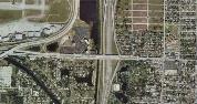
What is a PD&E Study?
A Project Development and Environment (PD&E) Study is a step in the Florida Department of Transportation's (FDOT) transportation development process. A PD&E Study assists the FDOT in determining the location, conceptual design and social, economic and environmental effects of the proposed transportation improvements. The process follows procedures set forth in the National Environmental Policy Act of 1969 and federal and state laws and regulations. During the PD&E Study process, feasible alternatives are developed for transportation improvement projects. These "Build" alternatives are evaluated based on environmental, engineering and socioeconomic conditions, safety needs and public input. The need for additional right-of-way for stormwater and environmental mitigation will also be evaluated during the PD&E Study phase. The "No-Build" alternative leaves the existing transportation infrastructure as it is, with only routine maintenance performed as required. The "No-Build" alternative is also evaluated throughout the study process. The basic activities of a PD&E Study include:
Data Collection
The first major work effort is the collection of all available data pertaining to the study corridor including existing infrastructure, traffic counts, existing and future land uses, drainage patterns, locations of wetlands and habitat for threatened or endangered species, and potential contamination sites.Alternatives Development and Analysis
Once data collection is completed, various alignment alternatives are developed and evaluated, including a “No-Build” alternative. The “No-Build” alternative assumes no improvements other than routine maintenance through the horizon year (for this study, the horizon year is 2040). The environmental impacts, social impacts and costs of these alternatives are quantified, summarized, and compared in an evaluation matrix.Public Kick-off Meeting
A public kick-off meeting is held to introduce the project to the public and provide an opportunity to view and comment on the project’s need and objectives. With input received at the kick-off meeting, the project team develops alternatives to present to the public at the alternatives public meeting.Alternatives Public Meeting
Combining the public input with the needs of the corridor, several improvement alternatives are developed and evaluated along with the “No-Build” alternative (which leaves the corridor as is) during the PD&E Study. This meeting presents the environmental and social impacts, as well as, estimated costs of the transportation improvement alternatives as compared to the “No-Build” alternative. The public is provided with an opportunity to view and comment on the alternatives under consideration.Public Hearing
After consideration of public input, and the analysis of the alternatives has been refined, a formal public hearing is held to provide a forum for additional feedback from property owners and interested parties on the final recommendations. A final decision is not made until after the public hearing.Final Acceptance
After the comments from the public hearing have been received, considered and addressed, the project reports will be finalized and submitted to the lead federal agency for final approval. The lead federal agency is the Federal Highway Administration (FHWA). Once approval and acceptance is granted, the PD&E Study phase of the project will be complete. The phases that follow the PD&E Study are design of the project, the acquisition of right-of-way, if necessary, and the construction of the improvements.
What is Level of Service (LOS)?
Level of Service (LOS) is a function of the average time vehicles will be delayed traveling through the corridor. LOS is measured on an A-F scale, with LOS A representing the best operating conditions from the traveler’s perspective and LOS F the worst. Click here for more information about traffic analysis.
What is an acceptable LOS for a state roadway?
The level of service standards for the State Highway System during peak travel hours are “D” in urbanized areas. LOS D represents congested conditions, however the roadway traffic should still move through the corridor at the posted speed limit.
When will the project be built?
Currently the project is funded for the final design phase in 2021, right of way acquisition in 2022 (if required), and construction in 2024. However, these dates are subject to change.
What is the construction phasing of the interchange projects along I-95?
As part of a previous study, the FDOT evaluated 17 interchanges in Palm Beach County to identify interim, and short- and long-term improvements that are needed. An overall construction sequencing / phasing plan of each interchange improvement is not known at this time, and construction of many of the improvements are not yet funded. SR-9 / I-95 is classified by the State as a Strategic Intermodal System Facility (SIS) and is subject to specific rules pertaining to project funding and prioritization of construction projects along the corridor. The resources related to prioritizing SIS projects are posted on the FDOT Central Office’s website: http://www.dot.state.fl.us/planning/systems/documents/brochures/default.shtm#brochures.
From that website, the simplest reference is the Strategic Investment Tool (SIT) brochure:
http://www.dot.state.fl.us/planning/systems/programs/mspi/pdf/SIT%20Brochure%202013.pdf
A more in depth document that explains SIS prioritization is also available on that website:
http://www.dot.state.fl.us/planning/systems/programs/mspi/pdf/Prioritizing%20Florida's%20Highway%20Investments%202013.pdf
From these resources, it’s explained that capacity projects on SIS facilities originate from FDOT district offices and modal plan priorities. FDOT uses the Strategic Investment Tool (SIT) to evaluate and rank projects. Projects are reviewed to determine if existing funding commitments, phasing or timing issues, availability of funding for SIS projects and FDOT geographic distribution analysis affect them. Projects are funded based upon “needs” analysis in conjunction with the availability of funding.
There are 6 goals used in the SIT to help prioritize projects: Safety & Security, Maintenance & Operations, Mobility & Connectivity, Economic Competitiveness, Livable Communities, and Environmental Stewardship. There are multiple measure and factors evaluated to see how well a SIS project meets these 6 goals. Factors include crash ratios, level of service and volume to capacity ratio, population growth rate, and population density.
Will property access remain during construction?
The FDOT cannot deny access to any property during construction. Property access may be altered or rerouted, but not denied.
Is there a possibility that the Conniston Middle School drop off area could be reconfigured / rerouted to Lake Avenue instead of Parker?
As currently conceived, that area is not included in this project. However, if any of the alternatives encroach upon the school, it would be evaluated. Any decisions or details affecting the school travel patterns or access would involve the County, the school and the school board.
How is the project funded (Federal / state split)?
At this time, the project has both State and Federal dollars allocated to it. Currently, there are $7 million dollars in Federal funds in the year 2021 for the final design phase. For the construction phase, there is a combination of both State and Federal funds in the amount of $75 million dollars in the year 2024. It should be noted that the amount of funds, funding sources and timing of the funds availability, are all subject to change.
How is traffic measured / forecasted?
The FDOT uses a combination of methods to measure and forecast traffic, all are industry standard methods and can be quite complex. Some of the data and tools utilized in traffic studies include, but are not limited to, traffic counts, traffic patterns, type of vehicles, land use maps, planned developments, census data, published factors by research institutions, and other information. All this information, and projects included in the County’s Long Range Transportation Plan (LRTP), are used to build an area network, then factors are applied and the traffic simulation model is “run” to predict the future traffic conditions and patterns. A link to the current traffic model, the Southeast Florida Regional Planning Model (SERPM), http://www.fsutmsonline.net, as well as, a link to the Palm Beach County Long Range Transportation Plan, http://www.palmbeachmpo.org/LRTP, are provided for your reference.
Could other projects, such as a bridge project, skew the traffic data?
Traffic data for any project is evaluated many times, and at different times / seasons, to capture the most accurate data. Traffic effects from other area projects, both on-going and planned, are taken into account during the traffic analyses.
Will Parker Avenue be widened?
At this time, very minor improvements are being considered to increase the safety for bikes and pedestrians, but no major widening is planned. Currently, right of way acquisition along Parker Avenue is not anticipated.
Does FDOT know that Parker Avenue was just narrowed?
Yes, actually, FDOT worked with the City of West Palm Beach to secure grant funding to accomplish that project.
Are express lanes part of this project?
Express lanes are not included in this project, however, the alternatives evaluated as a part of this PD&E study should not preclude their potential, future implementation.
What is the SR 80 Action Plan?
It is a Corridor Action Plan to evaluate a 45-mile segment of SR 80, from US 27 to I-95 in Palm Beach County. The study area extends to include all lands and roadways within 2 miles of either side of the SR 80 corridor. The link to the SR 80 Action Plan website is included here for more information and your reference, http://sr80actionplan.com.
Where is the future traffic coming from if the east is already built out?
Traffic will be generated by future developments that are currently in the planning stage and the predicted, additional people moving into the area.